Taco Bell
Location data
Observed 2026-09-04. 8,266 collected records.
US: 8,266
Look inside the CSV
First 10 records from this snapshot. The downloadable CSV also includes identifiers and source-page URLs.
| Street address | City | Region | Postal code | Country | Latitude | Longitude |
|---|---|---|---|---|---|---|
| 16901 Hawthorne Blvd | Lawndale | CA | 90260 | US | 33.87723669755706 | -118.35292339324951 |
| 5591 Warrensville Ctr Rd | Maple Heights | OH | 44137 | US | 41.41046602614185 | -81.53686921298402 |
| 2026 Coney Island Ave | Brooklyn | NY | 11223 | US | 40.60763514470743 | -73.96220527589321 |
| 1162 31W Bypass | Bowling Green | KY | 42101 | US | 36.98261234913522 | -86.43907628958914 |
| 45 Salem Turnpike | Norwich | CT | 06360 | US | 41.513996925872505 | -72.1083330899917 |
| 139 Battlefield Blvd. S | Chesapeake | VA | 23322 | US | 36.71878919590016 | -76.23926074995904 |
| 805 E Main Street | Kent | OH | 44240 | US | 41.1540331558695 | -81.34729153943226 |
| 11585 Quail Roost Drive | Miami | FL | 33157 | US | 25.592023209034142 | -80.3798577189446 |
| 20925 Redwood Rd | Castro Valley | CA | 94546 | US | 37.694028668477095 | -122.07418681005947 |
| 5611 S La Grange Rd | Countryside | IL | 60525 | US | 41.78832825319039 | -87.86825188656755 |
All CSV fields and fill rates
| Field | Records with a value |
|---|---|
| entity id | 100% |
| name | 100% |
| street address | 100% |
| city | 100% |
| region | 100% |
| postal code | 100% |
| country | 100% |
| latitude | 100% |
| longitude | 100% |
| phone | 100% |
| 0% | |
| opened on | 0% |
| timezone | 100% |
| google place id | 0% |
| hours | 100% |
| url | 100% |
| attributes | 100% |
See the footprint
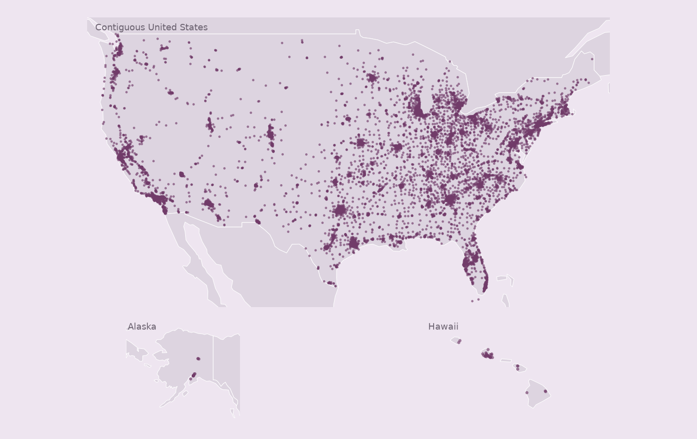
Coverage and interpretation
These records passed structural, field-completeness and internal count checks. National completeness has not been independently verified. Country codes describe the records included in this collection.
0 source entries were excluded; see the collection report in the ZIP for reasons.
Change records describe differences between snapshots. A record appearing or disappearing does not establish a physical opening or closure. Previous snapshot: 2026-07-27.csv.