Pollo Tropical
Location data
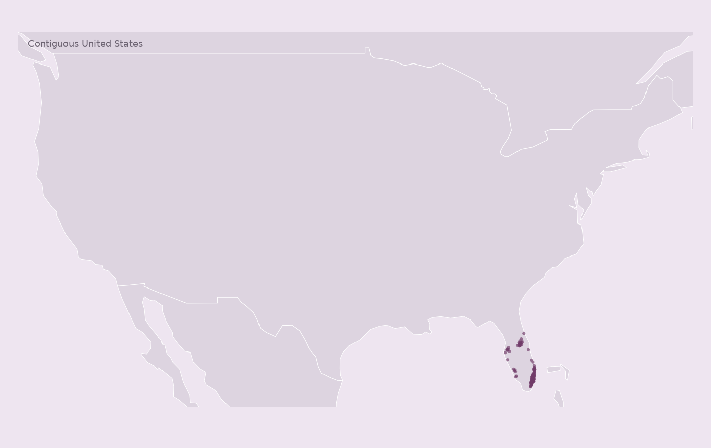
Observed 2026-09-04. 122 collected records.
US: 122
Look inside the CSV
First 10 records from this snapshot. The downloadable CSV also includes identifiers and source-page URLs.
| Street address | City | Region | Postal code | Country | Latitude | Longitude |
|---|---|---|---|---|---|---|
| 741 N. W. 37th Avenue | Miami | FL | 33125 | US | 25.77913427330474 | -80.25497521241756 |
| 9520 S. W. 137th Avenue | Miami | FL | 33186 | US | 25.679321305965715 | -80.41697644968546 |
| 8975 S. Dixie Highway | Miami | FL | 33156 | US | 25.68715096643282 | -80.31004143898 |
| 8700 Bird Road | Miami | FL | 33165 | US | 25.73237249218765 | -80.33620239879178 |
| 18710 S. Dixie Highway | Miami | FL | 33157 | US | 25.595083822728515 | -80.35618179032764 |
| 11521 N. Kendall Drive | Miami | FL | 33176 | US | 25.686817718659295 | -80.38030954145847 |
| 1785 N. E. 163rd Street | N. Miami Beach | FL | 33162 | US | 25.926418969346354 | -80.16428514293956 |
| 4211 N. W. 36th Street | Miami Springs | FL | 33166 | US | 25.80871427081329 | -80.26531737607479 |
| 2710 S. Dixie Hwy | Miami | FL | 33133 | US | 25.739088877004633 | -80.2387525073576 |
| 16495 N. W. 67th Avenue | Miami Lakes | FL | 33014 | US | 25.922799277932278 | -80.30873602461126 |
All CSV fields and fill rates
| Field | Records with a value |
|---|---|
| entity id | 100% |
| name | 100% |
| street address | 100% |
| city | 100% |
| region | 100% |
| postal code | 100% |
| country | 100% |
| latitude | 100% |
| longitude | 100% |
| phone | 100% |
| 0% | |
| opened on | 0% |
| timezone | 0% |
| google place id | 92% |
| hours | 100% |
| url | 100% |
| attributes | 100% |
See the footprint
Coverage and interpretation
These records passed structural, field-completeness and internal count checks. National completeness has not been independently verified. Country codes describe the records included in this collection.
0 source entries were excluded; see the collection report in the ZIP for reasons.
Change records describe differences between snapshots. A record appearing or disappearing does not establish a physical opening or closure. Previous snapshot: 2026-07-27.csv.